


I ain't afraid of no ghosts
In which we define "thunderplump" and hear more about AI.
Tell me about Ciarán
Ciarán was a strong storm that hit western Europe last week. It was notable for several reasons: strong winds, heavy rain, and it qualified as a bomb cyclone. One of the reasons I wanted to mention it though, was that its origins are related to the cold front that passed through the U.S. recently. Just another reminder that weather impacts us all, and even after it passes us by, it’s just starting to impact others. You can find some pretty neat imagery of the storm over here.
Weather meets AI
AI has been in the news so much recently you’re probably getting a bit tired of hearing about it. However, I’ve recently run into a some places where AI is being used to improve forecasting and our understanding of the weather. Here are just a few:
MetNet-3: a deep learning model for weather forecasting built by Google.
Worldshphere.ai: AI being used to improve hurricane forecasts.
Gale: Tomorrow.io’s weather and climate-generative AI.
Atmo.io: using AI to improve weather forecasting but also to make meteorology and weather forecasting universally accessible.
This certainly isn’t an exhaustive list but it’s a neat subset of what’s going on out there. Worldsphere.ai and Atmo.io are particularly interesting because they’re trying to make weather forecasting available to more people, countries, governments, etc. They seem to understand that forecasting resources aren’t available equally and are doing something about it.
More temps for the record books
Much of Asia and parts of North Africa have seen record high temperatures in recent days. We’re used to hearing about heat domes but geez! I could have pulled quotes from just about anywhere in the article, but let’s go with this one about Japan.
In Japan, at least 122 stations set November high temperature records Thursday, including nighttime lows as warm as 86 degrees. With more than 300 more stations setting November record highs Friday, more than one-third of the country had seen its warmest November weather.
Stronger together (unfortunately)
A new study that focused on the central U.S. has found that climate change increases straight line winds generated by thunderstorms. But why do we care? Well…
The new study, published this week in Nature Climate Change, shows that the central U.S. experienced a fivefold increase in the geographic area affected by damaging thunderstorm straight line winds in the past 40 years. The research uses a combination of meteorological observations, very high-resolution computer modeling, and analyses of fundamental physical laws to estimate the changes in the winds, which are so short-lived and localized that they often are not picked up by weather stations.
The work was funded by NSF, which is NCAR’s sponsor, and by the MIT Climate Grand Challenge on Weather and Climate Extremes.
“Thunderstorms are causing more and more of these extreme wind events,” said NCAR scientist Andreas Prein, the author of the new study. “These gusts that suddenly go from no wind at all to gusts of 60 to 80 miles per hour can have very damaging impacts on buildings, power grids, and even human safety.”
Source: https://news.ucar.edu/132927/damaging-thunderstorm-winds-increasing-central-us
Imagine being there
Yelling seems like an appropriate reaction to me.

Office hours
Weather West/Daniel Swain held them yesterday. Here are my brief highlights:
Talked about climate sensitivity and climate communication
Climate sensitivity is our best estimate of how much the earth will warm for a given amount of greenhouse gas accumulation in the atmosphere
This sensitivity changes over time, it’s not static and is not exact
Bringing this up now because of recent studies/papers/conversations etc.
Important to look at new research within context of past work
Covered how aerosols have had a cooling effect (which partially offsets global warming but does not cancel it out), and that aerosols are being reduced (this is good because it improves air quality) but that also means the cooling effect is reduced
This session was a bit different and the focus on communication was really interesting. We’ve talked about weather and climate communication before, and I’m sure we’ll talk about it again!
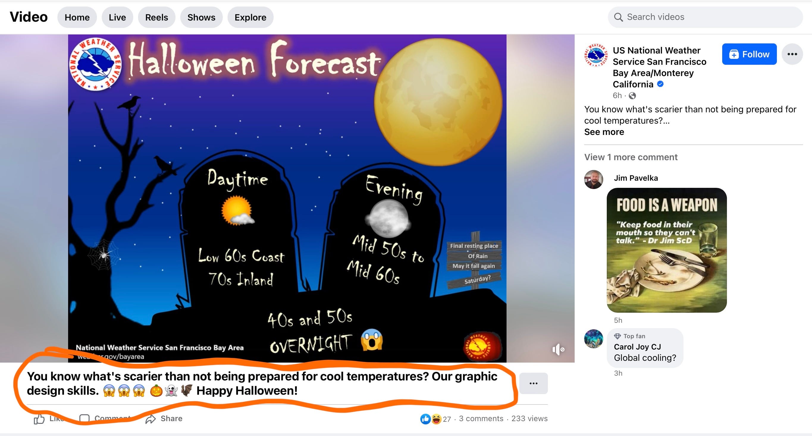
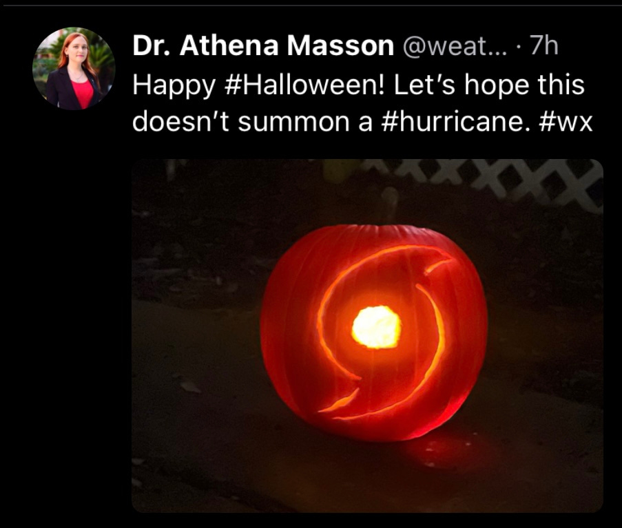
Happy belated Halloween 🎃
If you didn’t get enough on the 31st, here’s a cute video with some “spooky weather”. And here’s a gem from my local NWS office.
And finally, this hurricane pumpkin which looks a whole lot better than anything I could do.
From the NWS glossary
We’re actually going to pull from a different resource because this term doesn’t appear in the NWS glossary.
Thunderplump
A heavy downpour of rain.
The usual
You know the drill. We’ve got 6-10 day precip. and temp. outlooks, convective outlooks, and the drought monitor.


Sources:
https://www.spc.noaa.gov/products/outlook/
https://www.ncei.noaa.gov/news/us-drought-weekly-report-october-31-2023
https://www.cpc.ncep.noaa.gov/products/predictions/610day/
That’s it for now
See you next time weather fam! I’ll leave you with a real mish-mash of photos. We’ve got a small piece of blue sky beyond some rain clouds, sunset on the Pacific, and sunrise in Colorado.


