


Let's rake some leaves
In which we profess our love for fall and learn about katabatic winds.

The amazin’ Bolaven
This typhoon in the Pacific hit cat 5 and became the second strongest storm this year (I think Mawar is #1). As you might expect, it went through rapid intensification.
Bolaven began as a disorganized swirl but underwent one of the most impressive bursts of rapid intensification on record between Tuesday and Wednesday. It exploded from a Category 1 storm with 90 mph winds to a Category 5-equivalent violent typhoon with 160 mph winds in just 12 hours. That’s four times the rate needed to qualify as “rapid intensification.”
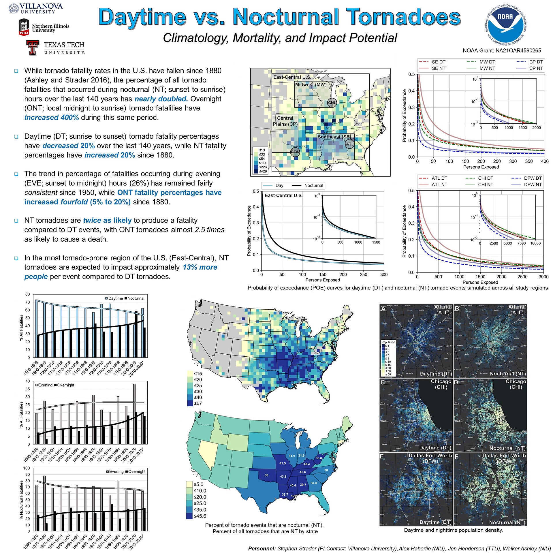
Some tornado takeaways
A recent study took a look into daytime vs. nocturnal tornado vulnerability. Here’s a quick summary from one of the authors.

I know that infographic is pretty small so here’s the big version:
Time for a timelapse
It has mammatus clouds and a double rainbow.
How do mammatus clouds form?
Mammatus clouds are usually formed in association with large cumulonimbus clouds. Typically, turbulence within the cumulonimbus cloud will cause mammatus to form, especially on the underside of the projecting anvil as it rapidly descends to lower levels. This reverses the usual cloud-forming process of upward growth, making for an uneven cloud base.
It’s time again
To get an update on El Niño. We have a few resources to mention:
Weather West office hours (see subsequent section for some more details)
While there’s more to it than this, I’ll pull the intro from the ENSO blog post to sort of sum things up:
El Niño is currently purring along in the tropical Pacific. Forecasters expect El Niño will continue through the spring, with a 75-85% chance it will become a strong event. A stronger El Niño—definition to follow shortly—means it is more likely that we will see El Niño’s expected thumbprint on winter temperature and rain/snow patterns around the world.
I love you fall 🍁
If you’re also a fan of this time of year, you might find this resource interesting. It’s an entire site devoted to fall foliage!
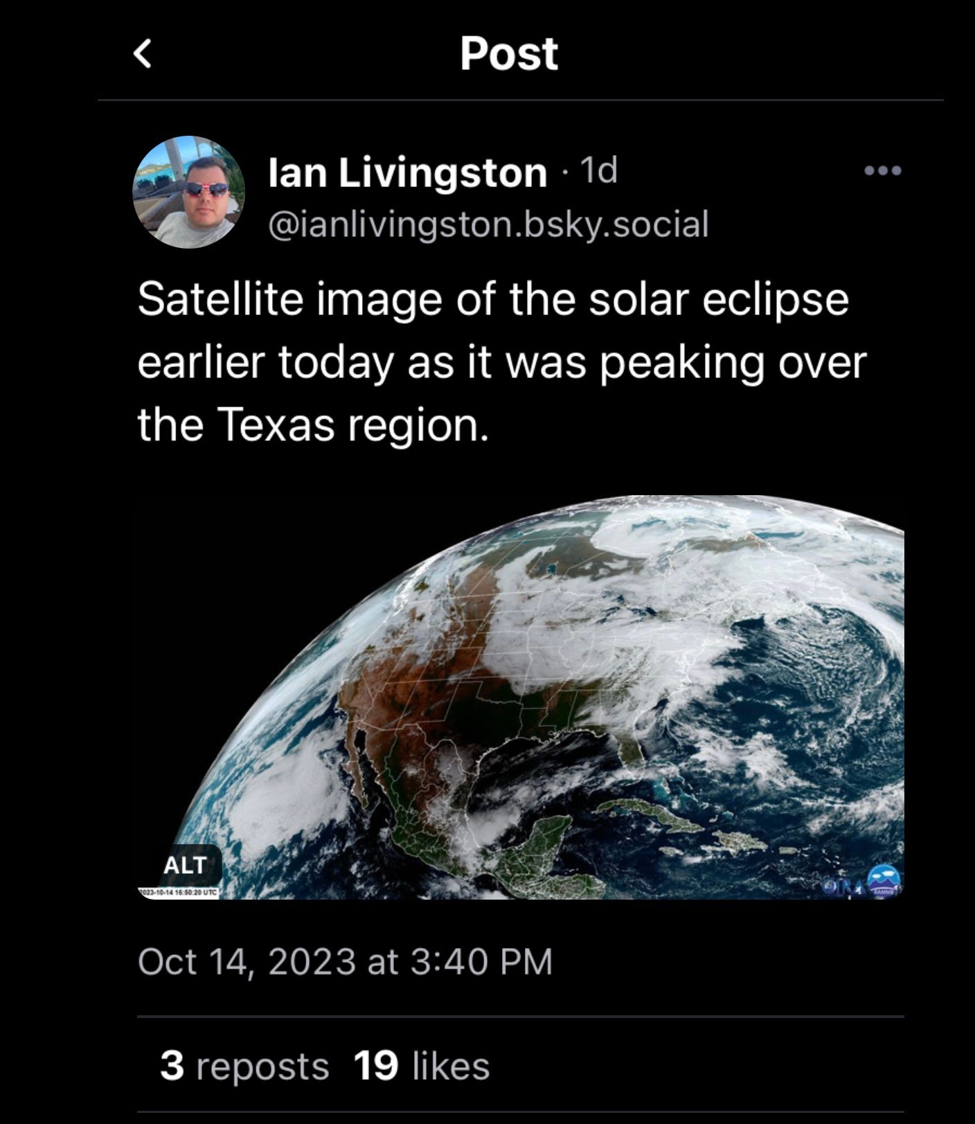
I know you know
I’m sure you’ve already seen a ton of photos of the eclipse so I’ll just share one. It was so foggy and cloudy here that the only thing we really noticed was that it got a little darker.
Weather West office hours notes
They were today! Topics were:
Upcoming late-season heatwave in California, plus new thoughts regarding recent record-shattering global temperatures and the potential effects of a strong El Niño on California winter precipitation.
My brief highlights:
Short term weather in CA: mix of dry and wet conditions lately, ridge incoming so temps are going to get pretty warm for a few days.
El Niño: recent (seasonal) forecast models still kind of have a mix of outcomes for CA. Central and SoCal seeming to tilt towards wetter winter and more intense storms. Fairly unclear what happens in NorCal. Oceans are still really warm, kind of a unique situation with incoming El Niño and these warm ocean temps.
From the NWS glossary
Brought to you by the letter “K” today.
Katabatic Wind
A wind that is created by air flowing downhill.
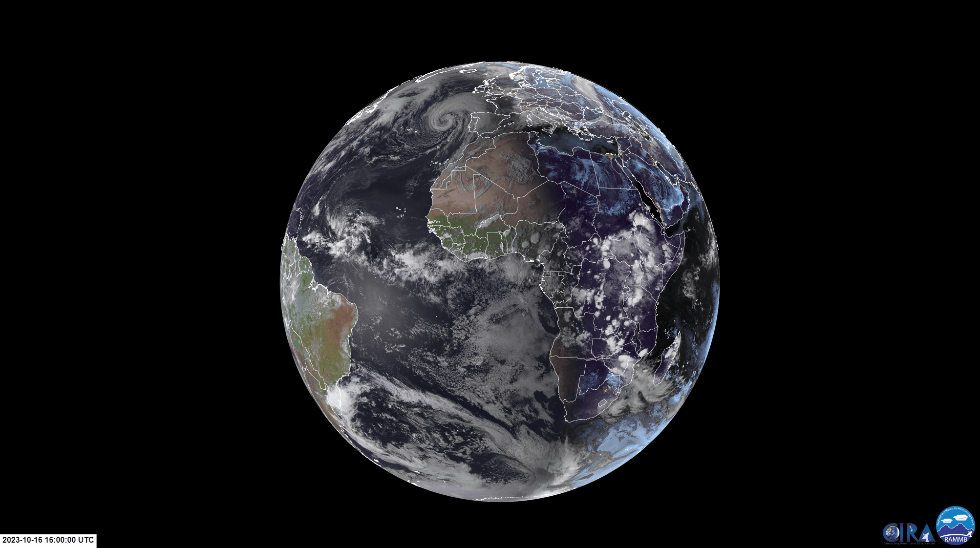
Some satellite imagery
Let’s go somewhere different this time shall we?
The usuals
We’ve got convective outlooks, and 6-10 day precip and temp outlooks.


Honorable mentions
And here are a few other things I ran into in the last week or so:
Hurricane Lidia made landfall in Mexico (it went through pretty rapid intensification and made landfall as a cat 4)
September global climate highlights, September U.S. climate highlights (turns out September was hot)
That’s it for now
See you next time weather fam 💙. I’ll leave you with a few photos from the last ~week.


